
Global Maritime Distress and Safety System
Explanation by Inmarsat
|
|
What is GMDSS? Global Maritime Distress and Safety System Explanation by Inmarsat |
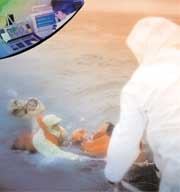
The Global Maritime Distress and Safety System (GMDSS) is an international system that uses terrestrial and satellite technology and ship-board radio systems to ensure rapid, automated alerting of shore-based communication and rescue authorities, in addition to ships in the immediate vicinity, in the event of a marine distress. Under the GMDSS, all cargo ships of 300 gross registered tonnes and upwards and all passenger ships engaged on international voyages must be equipped with radio equipment that conforms to international standards as set out in the system. The basic concept is that search and rescue authorities ashore, as well as shipping in the immediate vicinity of the ship in distress, will be rapidly alerted through satellite and terrestrial communication techniques so that they can assist in a co-ordinated search and rescue operation with the minimum of delay. How does the GMDSS help in distress situations? |
|
Who adopted the GMDSS? The GMDSS was adopted by the International Maritime Organisation (IMO), a specialised agency of the United Nations with responsibility for ship safety and the prevention of marine pollution. The GMDSS was adopted by means of amendments to the International Convention for the Safety of Life at Sea (SOLAS), 1974. The amendments, contained in Chapter IV of SOLAS on Radiocommunications, were adopted in 1988 and entered into force on 1 February 1992 but provided for a phase-in period until 1 February 1999.
Who is implementing the GMDSS?
|

|
When did the GMDSS fully take effect? The final, global implementation of GMDSS became fully effective on 1 February 1999. On that date, all applicable ships had to comply with the GMDSS requirements in SOLAS.
Who has to comply with the GMDSS?
What do ships have to do to comply with GMDSS?
Area A1: Within range of VHF coast stations with continuous DSC alerting available (about 20-30 miles) Area A3: Beyond the first two areas, but within coverage of geostationary maritime communication satellites (in practice this means Inmarsat). This covers the area between roughly 76� North and 76� South. Area A4: The remaining sea areas. The most important of these is the sea around the North Pole (the area around the South Pole is mostly land). Geostationary satellites, which are positioned above the equator, cannot reach this far. Coastal vessels, for example, only have to carry minimal equipment if they do not operate beyond the range of shore-based VHF radio stations, but they may also carry satellite equipment. However, some coasts do not have shore-based facilities so, although the ship is close to shore, the area counts as Area A2 or A3. Ships which do go beyond Sea Area A1 have to carry MF equipment as well as VHF - or Inmarsat satellite equipment. Ships which operate beyond MF range have to carry Inmarsat satellite equipment in addition to VHF and MF. Ships which operate in area A4 have to carry HF, MF and VHF equipment. |

|
Distress Alerting: The method of distress alerting can depend on the sea area in which the ship is saiing and alos on the equipment carried. The likely methods of initiating a distress alert in each of the four sea areas are shown below:
Sea Area A1Do all ships have to have satellite communications? No. If ships are travelling only in coastal areas served by VHF coast stations with continuous digital selective calling (DSC) available, they need only carry VHF equipment. However, they may use satellite communication in addition to or instead of terrestrial radio links. What about the problem of false alerts? One of the main reasons for false distress alerts is improper use of GMDSS equipment by untrained or inadequately trained personnel. They are probably also caused by the lack of practical experience of GMDSS equipment onboard ships by trained personnel. IMO has issued guidelines on avoidance of false alerts and has introduced a standard button design, which means that the distress button has to be protected and must be held down for at least 3 seconds to be activated. There are problems with equipment design and poor training. EPIRBs have to be sensitive, because they have to be able to float free, and this sensitivity can sometimes lead to false alerts. But information from manufacturers and coastal states indicate that, on average, there is only one false alert every 50 years from each of the alarms now available. At the same time, the GMDSS system makes it possible for the ship in distress to be contacted, to check whether the alert is real or false, before search and rescue operations begin.
What do coastal States have to do to ensure the GMDSS will work? |
Please use your back button to return
Quote Form * News * Glossary * Links * Builders * Email * Home
| CARIBBEAN BOAT and YACHT I N S U R A N C E |
|
| by W.R. Hodgens Marine Insurance, Inc. | |
| 1425 South Andrews Ave Suite 250 | Fort Lauderdale, FL 33316 |
| Ph: 954-523-6867 | Fax: 954-523-6488 |
| Toll Free USA: 800-990-WAVE (9283) | |